A GIS is a system (hardware + database engine) that is designed to efficiently, assemble, store, update, analyze, manipulate, and display geographically referenced information (data identified by their locations).A GIS also includes the people operating the system and the data that go into the system.
Ecotect Analysis offers a wide range of simulation and building energy analysis functionality that can improve performance of existing buildings and new building designs. Online energy, water, and carbon-emission analysis capabilities integrate with tools that enable you to visualize and simulate a building’s performance within the context of its environment.
J.Halatsch about GIS | Autodesk® Ecotect® Analysis
Submission till Thursday, March 29th 2012, 18:00 by uploading to the student server
– afp://schmitt-server.ethz.ch/schmitt-stud
– smb:\schmitt-server.ethz.chschmitt-stud
Deliverables:
- one .pdf document with the Ecotect analysis of your future scenario of Altstetten and short description to each analysis (description below under “Ecotect Analysis”)
Please mark each document with your group name.
Naming scheme: E03_Group01_Surname1Surname2… .pdf
With this exercise you will do simulations and building energy analysis with your respective future scenario of Altstetten, Zurich.
During the exercise you will get to know the software Autodesk Ecotect and learn how to deal with the comprehensive concept-to-detail sustainable building design tool.
At the Mid-term Crit on April 16th you will present your results of this Ecotect exercise as well as your urban analysis and your first implementation into the CityEngine.
Ecotect Analysis ( 30pts)
- Please do the Ecotect Analysis with one of your created building block. For further help use the Ecotect tutorial.
- If you have not yet implemented your own project into the CityEngine, then please use the given file from the student server under 01_Materials -> 01_CE_file_Ecotect.
- For submission you have to do the Ecotect Analysis in your group with your own future scenario of Altstetten.
-
Please hand in images with the following information:
a. Two shadow images (one for the 21st of June and one for the 21st of December) with the Daily Sun Path and the Annual Sun path.
b. Two shadow ranges images (one for the 21st of June and one for the 21st of December). The rages have to go from 9:00 to 17:00.
c. An image with the Sun path Diagram for each day.
d. Two images for the Solar Access Analysis without setting the grid (one for summer and one for winter).
e. Two images for the Solar Access Analysis with the grid on the xy plane base (one for summer and one for winter).
f. Two images for the Solar Access Analysis with the grid on a facade (one for summer and one for winter).
g. An image of the Daylight factor analysis on the xy plane base.
h. An image of the Daylight factor analysis on a facade.
i. One image of the Spatial Visibility Analysis.
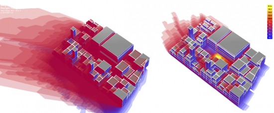
j. One image of the wind flow analysis. (optional)
k. One image of the acoustic analysis.
Remember to set up at the beginning the Location and the Weather data.
Note:
The participation in the workshop is mandatory.
Support requests by email iaurbansim@arch.ethz.ch are possible anytime.


